Planning Factors
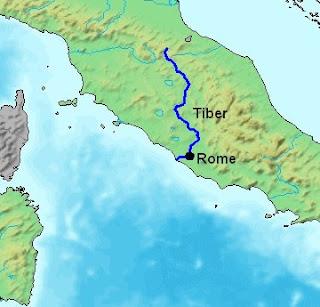
- Modern Rome has been shaped by its past dating back centuries. Planning factors were decided long ago, beginning with Rome’s establishment near the Tiber River and Alban Hills around 753 BC. This site offered many benefits as the river was a natural border, it flowed through the city offering water, transport, and sewage disposal, and the hills gave a safe defensive position. The site was also located on an intersection between two principal roads leading to the sea coming from Sabinum in the Northeast and Etruria in the Northwest.
- The Ancient Romans used a specific scheme for city planning that centered around military defense and civil convenience.
- The basic city plan consisted of a central forum with city services, surrounded by a compact grid of streets and wrapped in a wall for defense. The wall was also used to mark the city limits and was covered by a Portcullis, or fortified gate at the front of the city.
- They would lay out the streets at right angles, in the form of a square grid. All roads were equal in width and length, except for two diagonal ones that intersected in the middle to form the center of the grid.
- Each square marked by four roads was called an insula, the Roman equivalent of a modern city block. Each main road held a gateway with watchtowers.
- The collapse of Roman civilization saw the end of Roman urban planning. The Ancient Roman city planning style is still very clear in Modern Rome and it has influenced many towns across Europe and the world.
